In post-earthquake Nepal, open data accountability
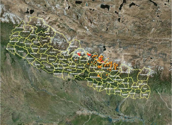
This map shows landslide sites. ICIMOD a team led by NASA and the United States Geological Survey (USGS) maps and monitors potential geohazards using satellite data. One of the first things I did after the earthquake on 25th April was …
In post-earthquake Nepal, open data accountability Read more »