Visualizing Open Data’s Global Reach
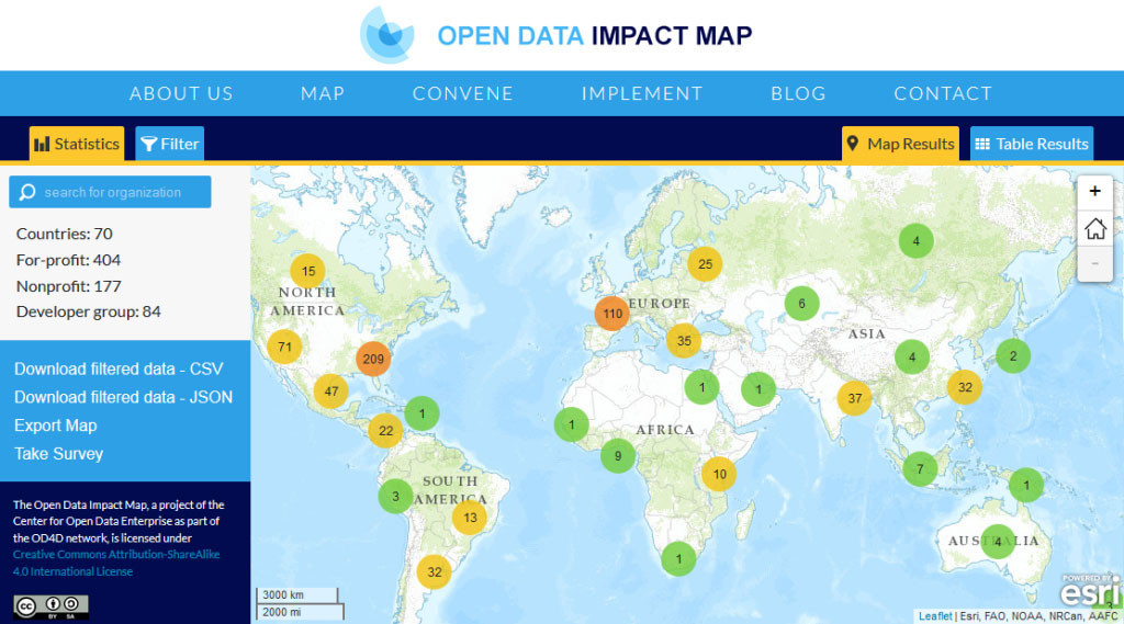
This article is cross-posted from the Blue Raster Blog. Blue Raster worked with the Center for Open Data Enterprise to build a mapping application showcasing a centralized, searchable database of organizations using open data worldwide. The Open Data Impact Map makes it …